"Pacific Islands Geographical Handbooks"
(published by the Royal Navy of the United Kingdom)
A reference used on board warships, at naval bases, & in embassies.
Based on information primarily from the 1930s and early 40s.
Posted with permission of the Ministry of Defense
Credits are located here
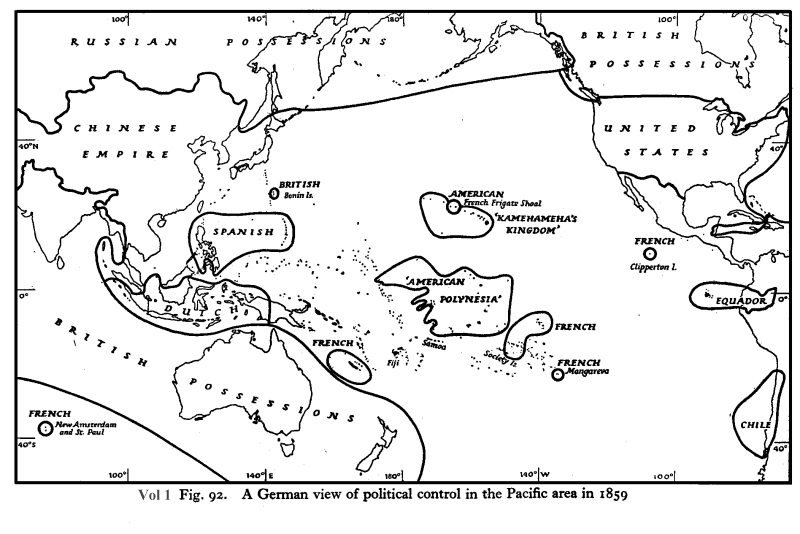
* A German view
(in 1859) of European Control in the Pacific *
(Paraphrased from the caption: The map is a general impression
of the time --
not all the political interest & control shown were formal
colonies.
The British interest in the Bonin Islands was never followed up.
The 'American Polynesia' indicated which islands American companies
were mining for phosphates (guano). No formal American sovereignty was
claimed.
The map does show which island groups were independent of outside
control.)
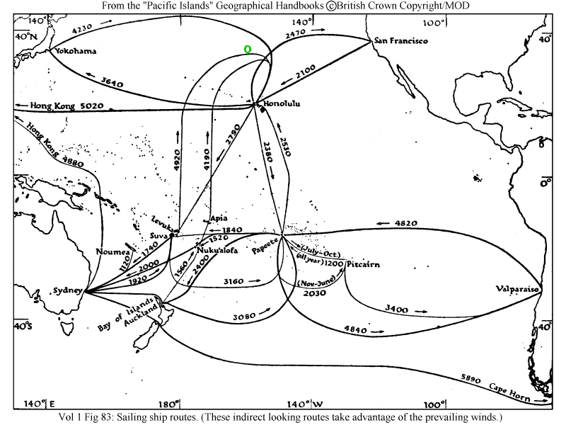
* Sailing Ship
Routes in the Pacific *
(As evolved from regular trading journeys -- routes that take
advantage of
prevailing winds in the Pacific Ocean. These indirect-looking routes
are
the fastest and most efficient sailing. The Spontoon Archipelago is
located approximately in the area indicated by the green circle.)
"Shipping
Routes in the Pacific, 1938-39"
(This file opens to a large 690 Kb!)
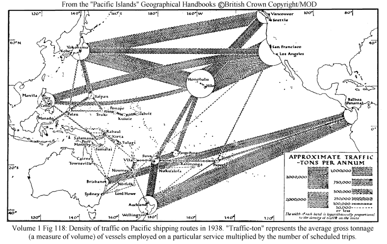
"Density
of traffic on Pacific shipping routes 1938"
(Opens to 386 Kb)
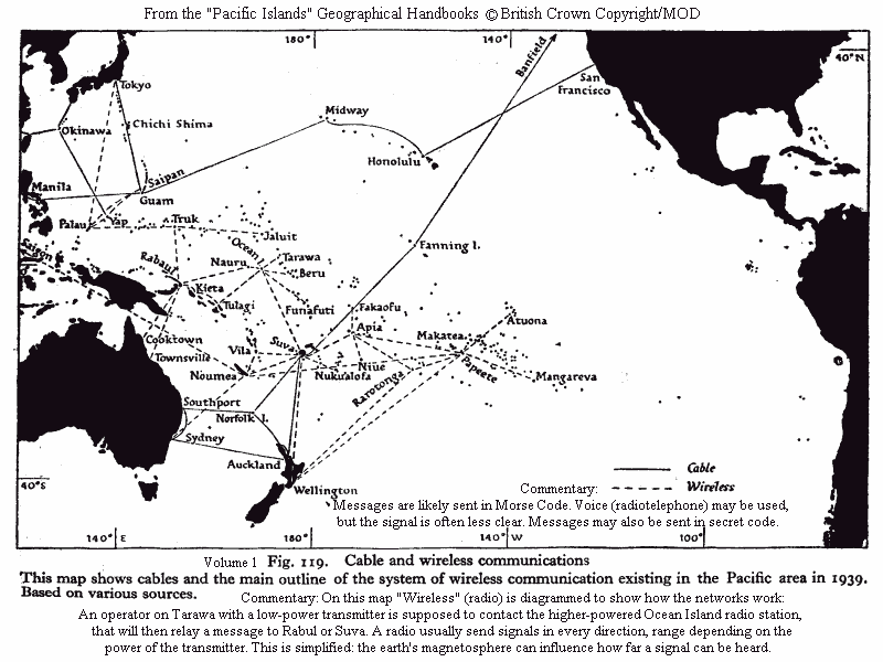
"Pacific Cable & Radio communications 1939"
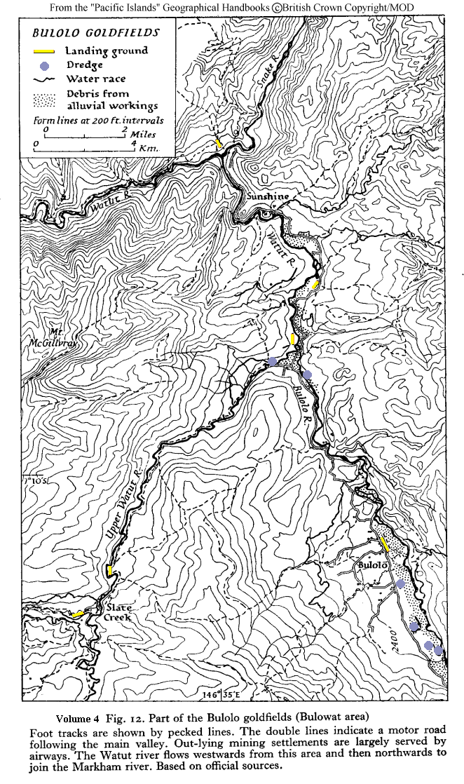
"A portion of the Bulolo goldfields, New Guinea"
(Opens to 363 Kb)
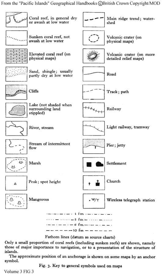
Key to local area maps
(as used in Pacific Islands Geographical Handbooks)
(Additional maps will be scanned and posted to this webpage,
but in addition, here is a link to some of these maps at
the Library of the University of Texas.)
http://www.lib.utexas.edu/maps/historical/pacific_islands_1943_1945.html