Spontoon Island
home
- contact - credits
- new - links -
history
- maps - art - story
comic
strips - editorial - souvenirs - Yahoo forum
* Update 4 July 2014 *
** Update 12 January 2015 (Art to Cranium Island) **
"I have data upon data upon data on new lands that are not far away."
(Charles Fort -- often-referenced captain of 1930s clippers)
Maps & Aerial Photos

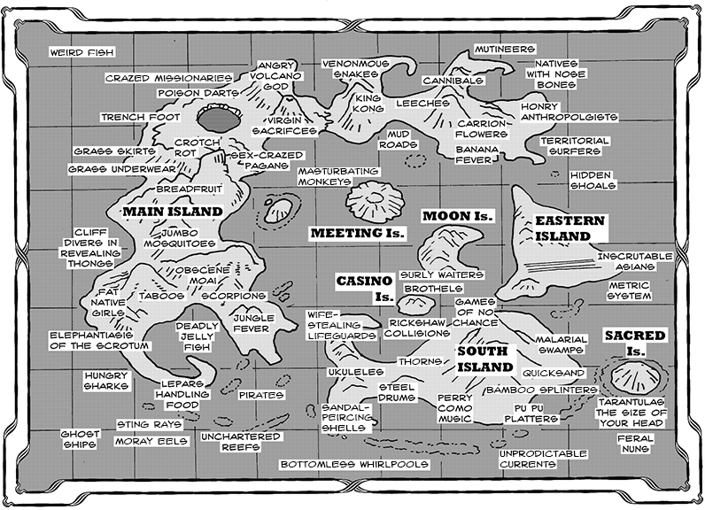
* "Pessimist's Map of Spontoon Island" (Larger file here - 448 Kb) *
Cartography, art, & notations by Dennis Clark
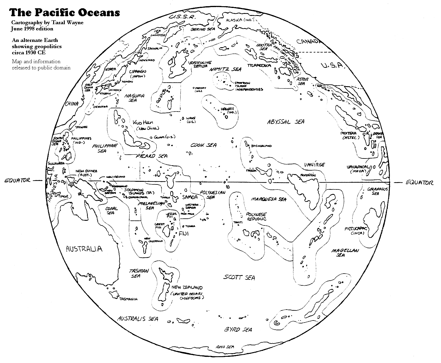
The Pacific Ocean
rim
of the Alternate World
(geopolitical cartography by Taral Wayne)
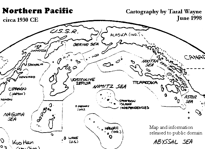
Northern Pacific
region
(geopolitical cartography by Taral Wayne)
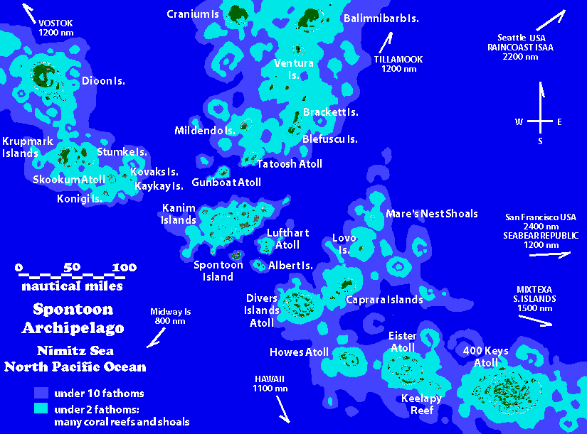
A map of the Nimitz
Sea
Islands (Spontoon Archipelago Region)
Views of some Nimitz
Sea
Islands
(Including
400
Keys Atoll)
(cartography by Ken
Fletcher)
"Islands of the Nimitz Sea:
History and Mystery"
-- an article from the collection of Walter
Reimer)
Krupmark
Island
(An association of criminals)
Geography, maps, views &
notes
(opens to a separate webpage)
Update 18 November 2010
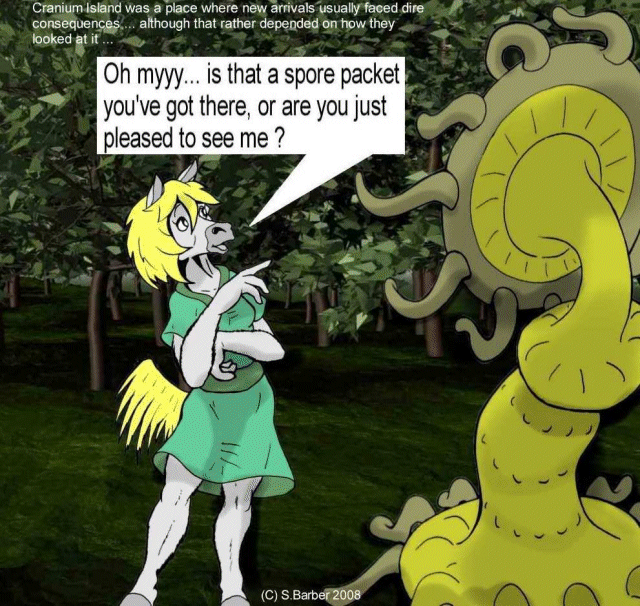
Betty the smuggler discovers
the wonders of Cranium Island
by Simon Barber
** Cranium
Island **
(The laboratory of the Mad Scientists)
Geography, maps, views
& notes
(opens to a separate webpage)

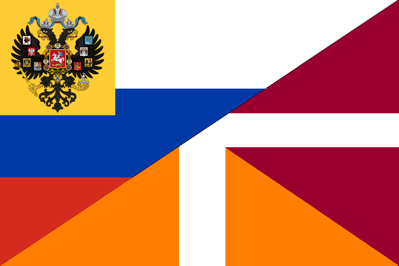
Flag of the Russian Empire-in-Exile (on the Vostok Islands), North Pacific
(circa 1919 to present). Design & art by Walter D. Reimer
Larger file here (1.6 MBytes)
Vostokiye Zemlya
Vostok Island
(Refuge of White Russia)
Geography, maps, views &
notes
(opens to a separate webpage)
Update 14 April 2012
("Vanirge, Where One Lands In
Hot Water"
--an article from the collection of Walter Reimer)
Spontoon
Archipelago
The Near
Archipelago
(including the Kanim Islands
Atolls)
Including Fishtrap Atoll, Pilgrim Atoll,
Albert Islands,
Orpington Islands, Lufthart Atoll, and diverse other islands &
reefs.
(Opens to 515 Kb)
(Cartography by Ken Fletcher & contributors)
(Released to Public Domain)
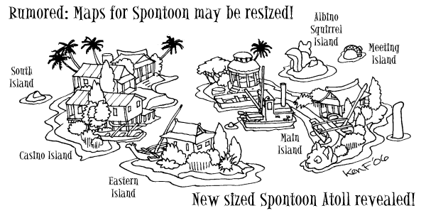
Spontoon Island
Casino Island, inside the
Spontoon Atoll's
Lagoon is at
160° W
Longitude & 35° N Latitude
That is almost directly north of Kauai Island or
Niihau Island in Hawaiian Islands.
The Latitude is near that of Yokohama, Japan, or just
south of Monterey, California.
Time Zone
The Spontoon Archipelago is -11 hours of GMT, Greenwich Meridian Time
(Zulu Time).
Spontoon Archipelago is in the "X" zone of the international naval
Standard Time Zones.
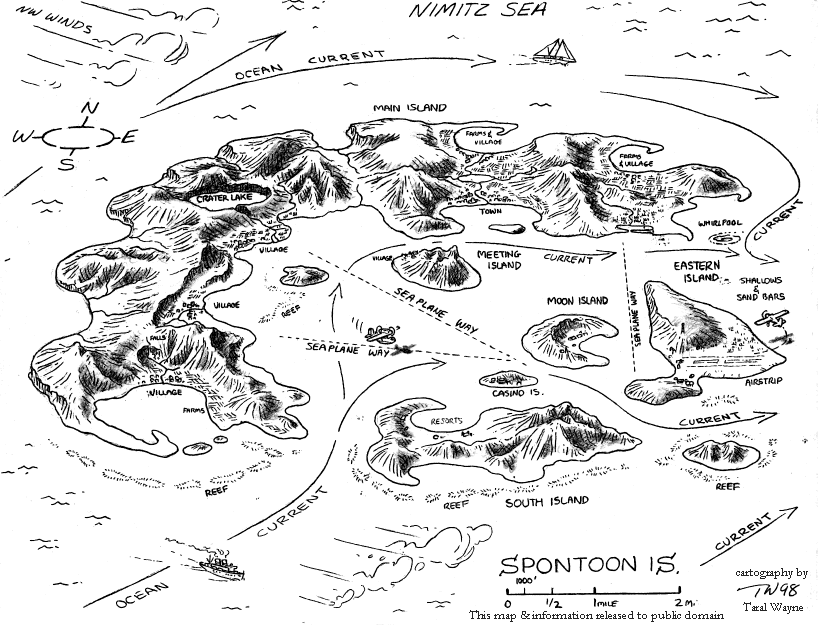
Spontoon Island Cruise
Map (bird's eye view)
(cartography by Taral Wayne)
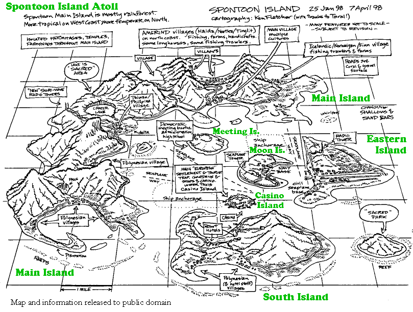
Spontoon Island
geography
(bird's eye view)
(cartography by Ken Fletcher)
(Released to Public Domain)
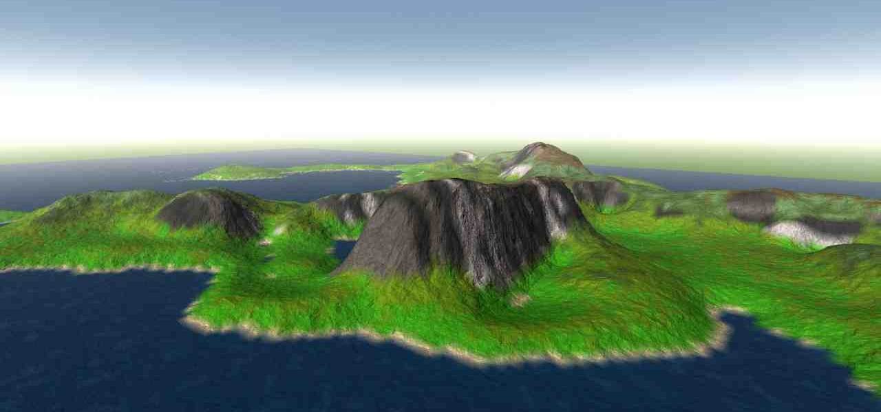
Spontoon
Island Aerial Photos
(cartography by Simon Barber)
High Altitude
View of Spontoon Atoll to NNE
(circa1946: Sagner-Brandt 1 aircraft in foreground)
(Opens to a Large 2 MBytes!)
View looking NorthEast
across
the Central Lagoon
(This file is compressed to 38K, but opens to
a Large
2.4 MBytes!)
View over Main Island
towards SE
(Opens to a Large 2.2 MBytes!)
View of the main
face
Mt. Kiribatori: SW area of Main Island.
(This file is compressed to 57 K, but opens
to
a Large 2.1 MBytes!)
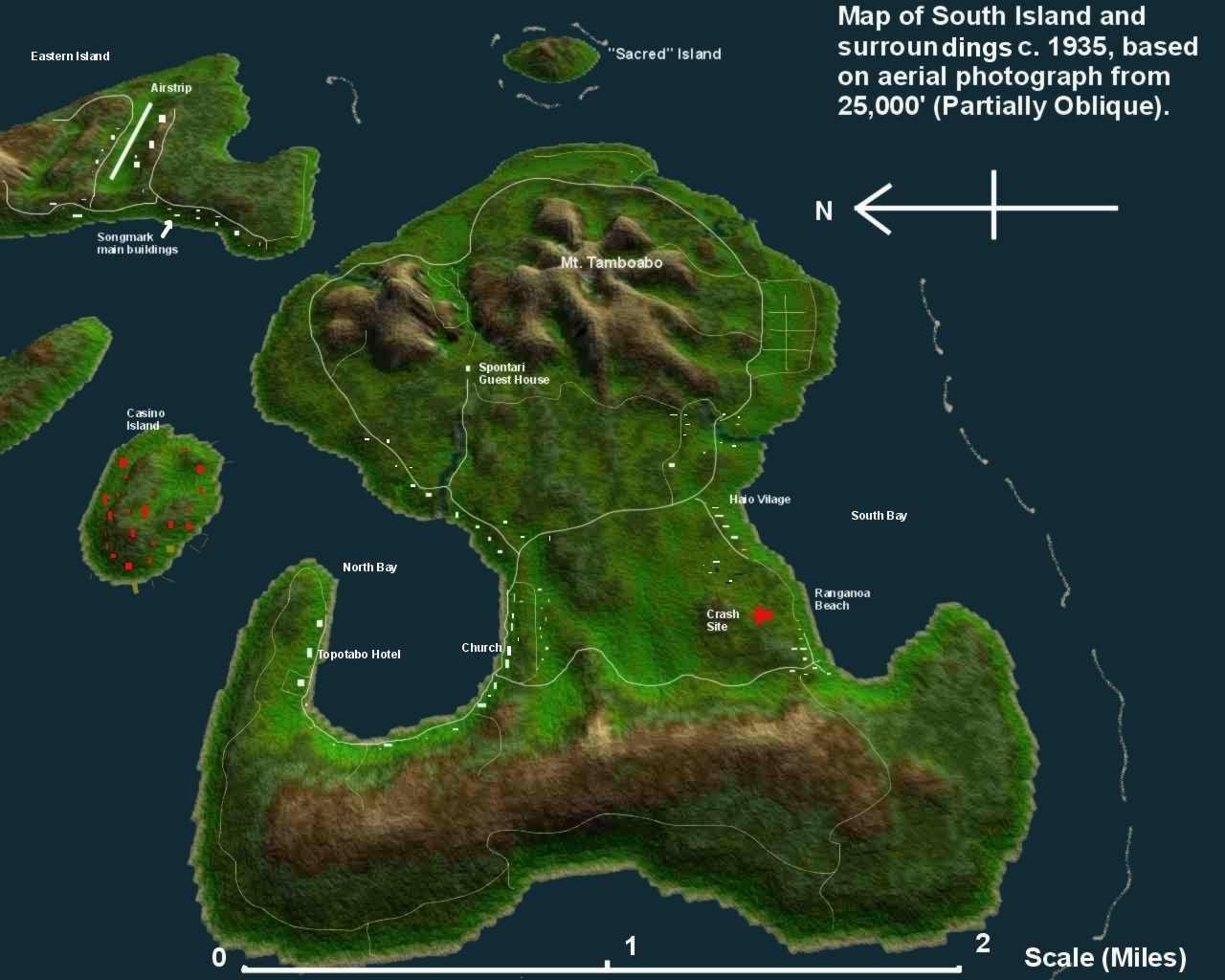
An Aerial Photomap
of
South
Island circa 1935
View to East from 25,000 ft (8,000 m) compiled from Songmark student
photos
Cartography by Simon Barber (Opens to a Large 3.7 MBytes!)

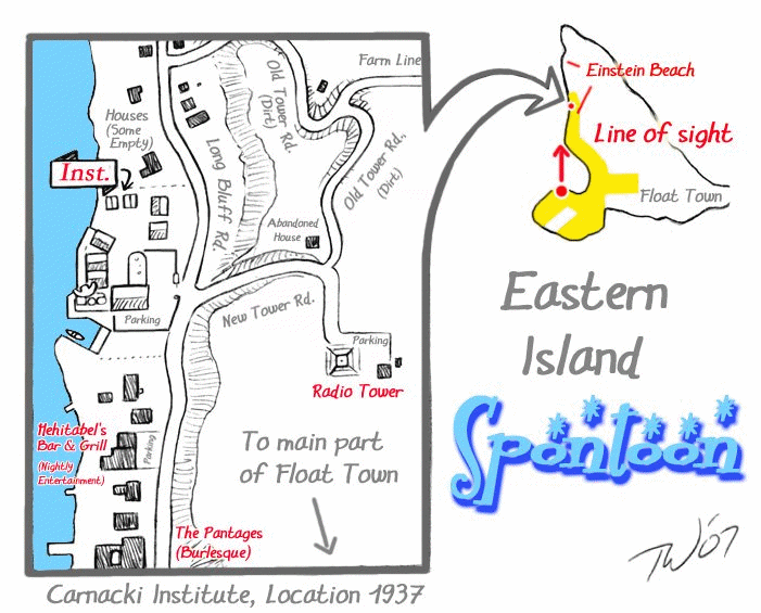
Part of "Float Town", Eastern Island
Map by Taral Wayne
(Larger file here - 389 Kb)
"Float Town" area of Eastern Island
A Few Footnotes on Eastern Island of
Spontoon
& Certain Other Subjects of
Local Interest
by Taral Wayne
Uploaded 7 December 2009
http://taralwayne.deviantart.com/
& http://www.furaffinity.net/user/saara/
Update 1 June 2011
"Notes on Mehitabel's..." (bar
& grill)
answers to questions from a story contributor
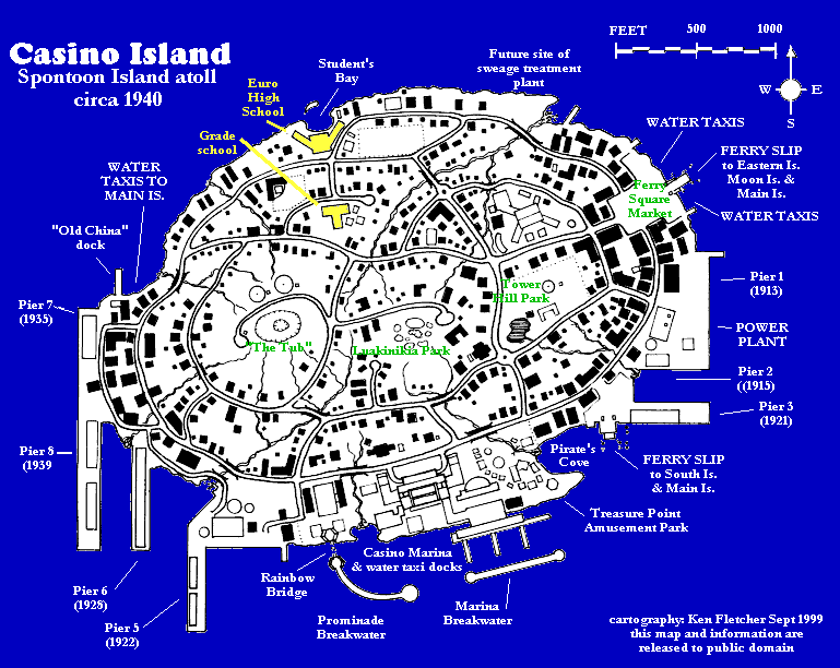
Casino Island
geodetic
survey
(cartography by Ken Fletcher)
(Released to Public Domain)
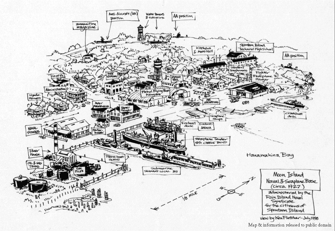
Rain Island Naval Syndicate
Base on Moon Island
(bird's eye view--cartography by Ken Fletcher)
(Released to Public Domain)
Songmark Aeronautical Boarding School
for Young Ladies (Songmark Academy)
campus map
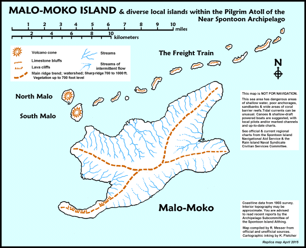
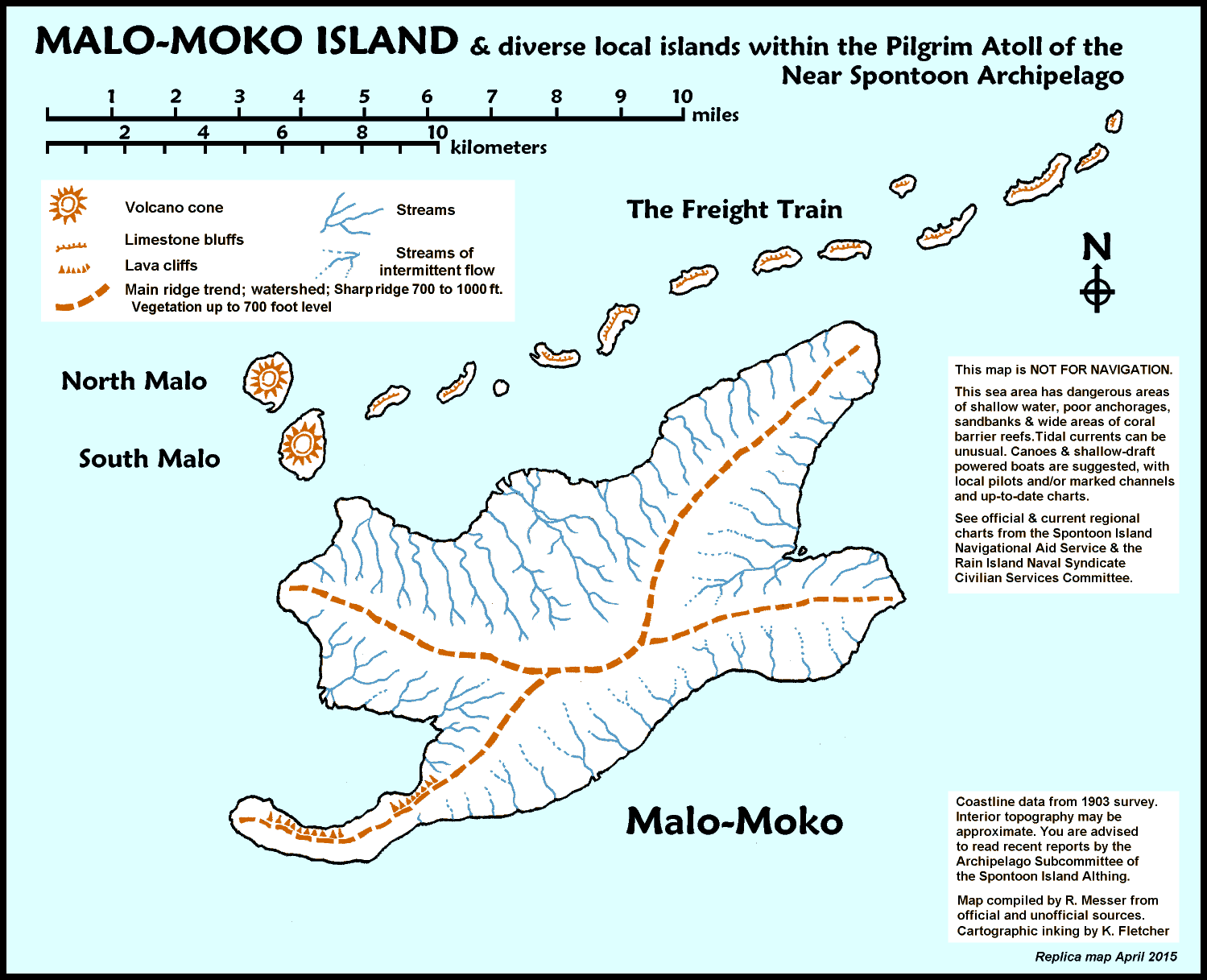
A map of Malo-Moko Island, in the Spontoon Archipelago
compiled & surveyed by R. Messer - cartography by K. Fletcher
Larger files here (772 KBytes) and here (893 KBytes)
Mapping
References
for artists, cartographers & writers
(opens to a new web page)